| Current Conditions: Hwy 80 at Donner Summit | |||
| Timestamp: 11/03/2025 05:38 PM | Historical Data | Detailed Graphs | Station List |
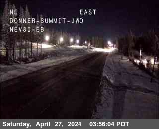
| Nearest CCTV (0.01 mi E) |
 |
| Location | |
| Near | Soda Springs |
| Longitude | -120.34782° |
| Latitude | 39.33906° |
| Elevation | 7221 ft |
| Direction | |
| County | Nevada |
| Route | I-80 |
| Milepost | 176.31 |
| Surface Sensors | |
| Sensor # | 1 |
| Surface Status | Dry |
| Surface Temperature | 32.00 °F |
| Pavement Temperature | |
| Surface Water Depth | |
| Surface Salinity | 0.00 pp100k |
| Surface Freeze Point | 32.00 °F |
| Surface Black Ice Signal | Detector Error |
| Temperature | |
| Air | 46.40 °F |
| Wet Bulb | x |
| Dewpoint | 34.16 °F |
| 24-hr Max | 63.86 °F |
| 24-hr Min | 33.44 °F |
| Avg | 0 mph from N |
| Spot | 0 mph from S | Max | 1.12 mph |
| Precipitation | |
| Y/N | No |
| Situation | No Precipitation |
| Rate | 0.000 in/hr |
| 1 hr | 0.000 in |
| 3 hr | 0.000 in |
| 6 hr | 0.000 in |
| 12 hr | 0.000 in |
| 24 hr | 0.000 in |
| Start | 10/26/2025 10:24 AM |
| End | 10/26/2025 10:26 AM |
| Visibility | Visibility | 1.489 mi |
| Visibility Situation | Unknown |
| Other | |
| Relative Humidity | 62% |
| Atmospheric Pressure | x |
Graphical Summary for
11/03/2025
12:00 AM through 05:38 PM
|
Air Temperature
|
Loading...
|
|
Dewpoint
|
Loading...
|
|
Relative Humidity
|
Loading...
|
|
Average Wind
|
Loading...
|
|
Wind Gust
|
Loading...
|
|
One-Hour Precipitation
|
Loading...
|
|
Precipitation Situation
|
Loading...
|
|
Surface Temperature 1
|
Loading...
|
|
Surface Status 1
|
Loading...
|